


Keyfuels app for iPhone and iPad
Developer: Caversham Telecom Ltd
First release : 01 Mar 2013
App size: 14.1 Mb
This application enables Keyfuels cardholders to find the nearest sites where they can use their card, display these sites on a map, list them, view their details and optionally open iPhone Maps with a route to a selected site.
How Keyfuels Sites Works
Keyfuels Sites uses the location capabilities of the iPhone to determine the current location and then download the nearest sites. Once downloaded, these sites can be displayed on a map and listed in ascending order of distance from the current location.
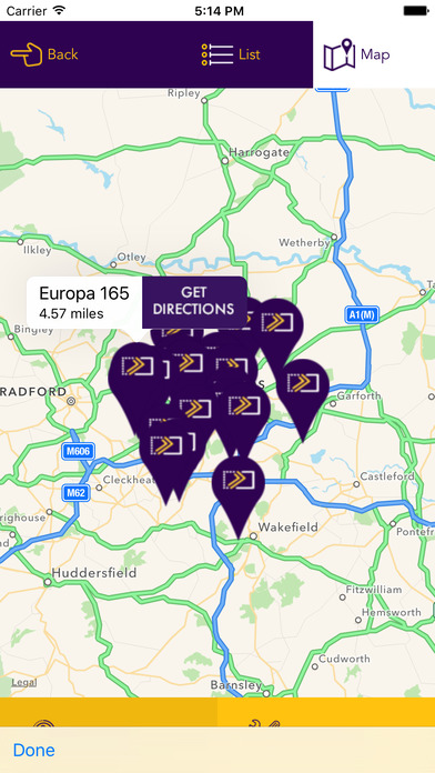
Maps
The maps support zoom and pan in the same way as iPhone Maps. By touching a sites icon, its details can be displayed.
The Nearest Sites List
Sites are listed in ascending order of distance from the current location. By selecting a site its details can be displayed.
Site Details
Site details can be displayed by selecting a site from a map or the Nearest Sites List. Site details include address, opening times, and directions.
A Route to a Site
There is an option to open iPhone Maps with a route to a selected site. This option automatically closes the Keyfuels Sites application.
Geographic Scope
There are approximately 1,860 Keyfuels sites throughout the UK including Northern Ireland.
Vehicle Type Selection
Keyfuels Sites enables you to select sites appropriate to your type of vehicle. There are three options:-
-All Keyfuels sites
-LCV/Car sites
-HGV sites only
Help
Keyfuels Sites includes context-sensitive, help screens.
Mobile Data
Keyfuels Sites uses mobile data to download the nearest sites in a compact data format and to download maps.